After an amendment, Montana adopts final congressional map
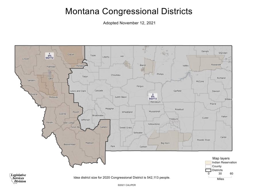
A final congressional map outlining the state’s two U.S. House districts was submitted to the Montana secretary of state’s office Friday. Montana’s redistricting commission reversed course on an earlier amendment.
The Montana Districting and Apportionment Commission made one final adjustment to the congressional map before sending it to the Secretary of State’s office.
The commission reversed an amendment from Democrats to split Pondera County along the Blackfeet Indian Reservation instead down the middle of the county.
Related Stories:
-
 Cromwell’s Office Under Fire Over No-Jail Plea Deal
-
 Knudsen Announces New Forensic Science Division Administrator
-
 U.S. Supreme Court allows late mail-in ballots to be counted
-
 Concerns raised that KIDS Act threatens Americans’ online privacy, free speech
-
 Gianforte Suspends PSC Commissioner Molnar for One Year
-
 Montana Students Earn Recognition at 2026 National History Day Contest